|
nancy@nancykeane.com
|
Click on the book to read Amazon reviews |
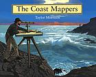
Morrison,
Taylor.
THE COAST MAPPERS
New York : Houghton Mifflin,
2004.
IL 3-6, RL 6.7
ISBN 0618254080
|
| Have
you ever gone on a trip to someplace you have never been? Maybe a
car trip with your parents. Usually we use a map to find out how
to get places. Or to try to figure out where we are when we're lost!
Well, what if you don't have a map? Or the map you have is wrong?
You aren't going to find your way around too easily. Back in the
early days of America, there were few maps available for the west coast.
And those were not very reliable. There were many ship wrecks due
to inaccurate maps. In 1807, the United States Coast Survey was created
with the goal of producing accurate maps for the shipping industry.
Without the benefits of GPS tracking or computers, these amazing men produced
the most accurate maps of the coast ever known. |
| Non fiction |
SUBJECTS:
Cartography -- Pacific Coast (U.S.)
Surveying Pacific Coast (U.S.)
United States Coast Survey.
Pacific Coast (U.S.) -- Maps.
Davidson, George, 1825-1911. |
© 
Permission is granted for the
noncommercial duplication and use of this resource, provided it is substantially
unchanged from its present form and appropriate credit is given.
|